The Government of Catalonia’s Department of Territory and Sustainability (DTES) has published maps of ecological connectivity that are available online through the hypermap of Catalonia, in the Ecological Connectivity section. This set of maps has been useful for drafting the Catalonia Green Infrastructure Programme 2017-2021.
The maps on ecological connectivity model the current degree of connection between different areas of the territory. They identify terrestrial and river connectors between protected natural spaces; large areas of interest for connectivity in which new barriers or changes in land use that fragment the territory should be avoided; and points of interest for marine connectivity such as rivers and coastal areas. Likewise, they determine critical points for connectivity where barriers such as road infrastructures or hydraulic infrastructures need to be reduced to guarantee the functionality of the connectors.
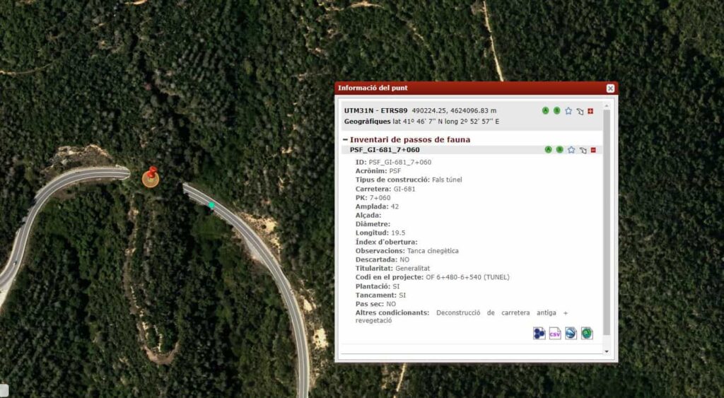
The Ecological Connectivity section also includes an inventory of wildlife crossings in the Catalan road network. The connectivity structures that currently exist in Catalonia can be consulted and are grouped into eight types, including ecoducts and overpasses and underpasses that are designed to improve the passage of fauna.
To draw up the inventory of fauna passages and map the ecological connectivity, the DTES received technical assistance from Minuartia.
You can check all the maps here.